 Vancouver BC. (360 kbytes)
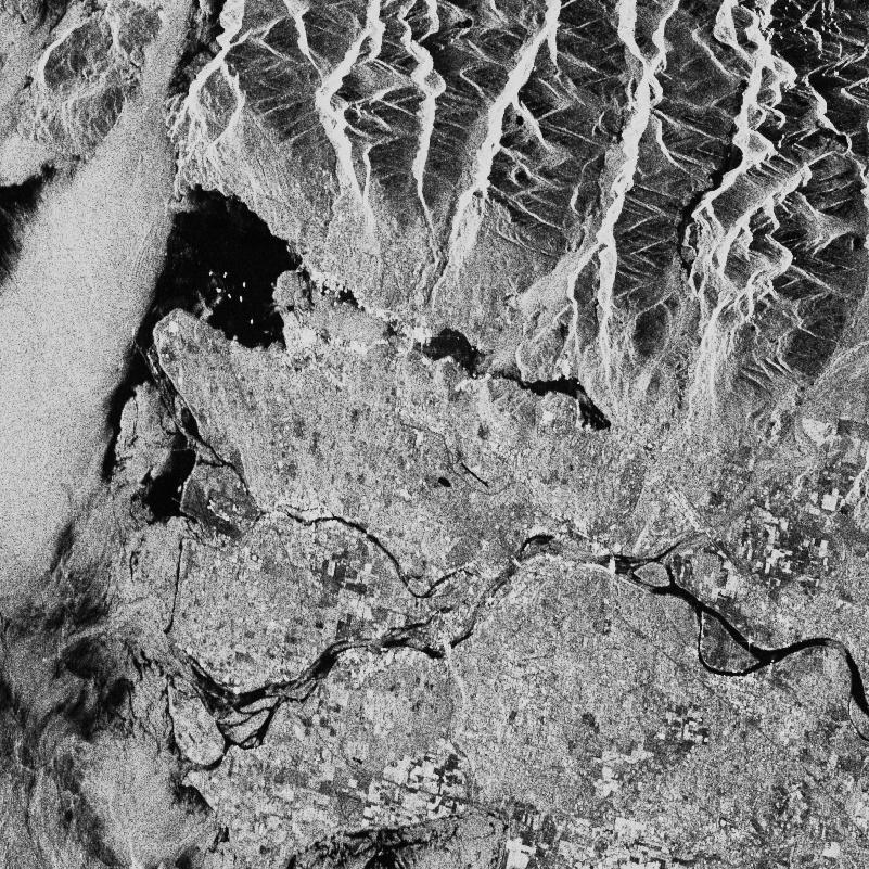
The SAR signal data was acquired by ERS-1 on April 24, 1992 (orbit 4044, frame 981). The scene center is approximately 49 11' N, 122 39' W, with north towards the top right corner. The city of Vancouver is near the upper left of the scene, with the suburbs and eventually farmland extending to the east and south. Approximately the lower quarter of the scene is in the United States, south of the 49th parallel. Mountains with elevations up to 1200 m fill the upper and lower right portions of the scene.
An image chip (241 KB) shows the upper left part of the scene in more detail. The city centre is at (280,310) pixels (the top left is (0,0) and the bottom right at (800,800)). Six large ships are anchored in English Bay, to the west of the city centre. At (160,300) lies the University of British Columbia, our home. To the west of the university lies the Straits of Georgia, where a bright area shows surface roughness caused by wind flowing out of Howe Sound. The Fraser River is seen flowing through the lower third of the scene.
Signal data was aquired by the ERS-1 SAR during orbit 3440, frame 1485 on Mar 13 1992. The scene center coordinates are 73 03' N, 78 24' W. This scene captures the north east coast of Bylot Island, extending south east from Cape Hay along the coast of Baffin Bay, just past Cape Walter Bathurst. There are numerous glaciers present in the scene, notably at the mouths of Bathurst Bay (bottom right quadrant) and Maud Bight (top left quadrant). The Byam Martin Mountains appear in the bottom left quadrant of the image as a fairly bright region. Sea ice features are clearly visible off the (top right) coast of the island. Of note also in this image is the appearance of a gradual fading of image intensity in far range (left to right) due to the (uncorrected for) range pattern of the ERS-1 antenna. An image chip (218 kbytes) shows the upper left corner of the image in more detail.
