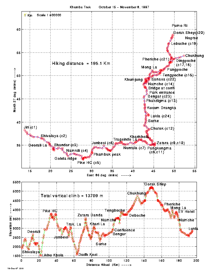
Here is a map of our whole trek. The top panel is a conventional map, while the bottom panel is a plot of elevation vs. distance travelled. I used a GPS on the trail, then plotted the points with MATLAB.
In total we trekked 195 Km, and about 14,000 metres up and down. That doesn't sound much spread over 23 days on the trail, but I assure you we were quite tired at the end of most days. For comparison, Mt. Everest is 3500m above its surrounding "lowlands" (which we got to at the base camp).
Where we camped each night is marked with a "c", e.g. (c13) is the camp after our 13th day. Day 1 is the bus ride from Kathmandu to Jiri, a 10-hour ride. The actual walking began on Day 2.
October 15 - November 8, 1997.

